Excerpt
Take notice that the Corporation of the City of Barrie is in receipt of a complete application as of Friday, April 17, 2026 for a proposed Official Plan Amendment and Amendment to the Zoning By-law.
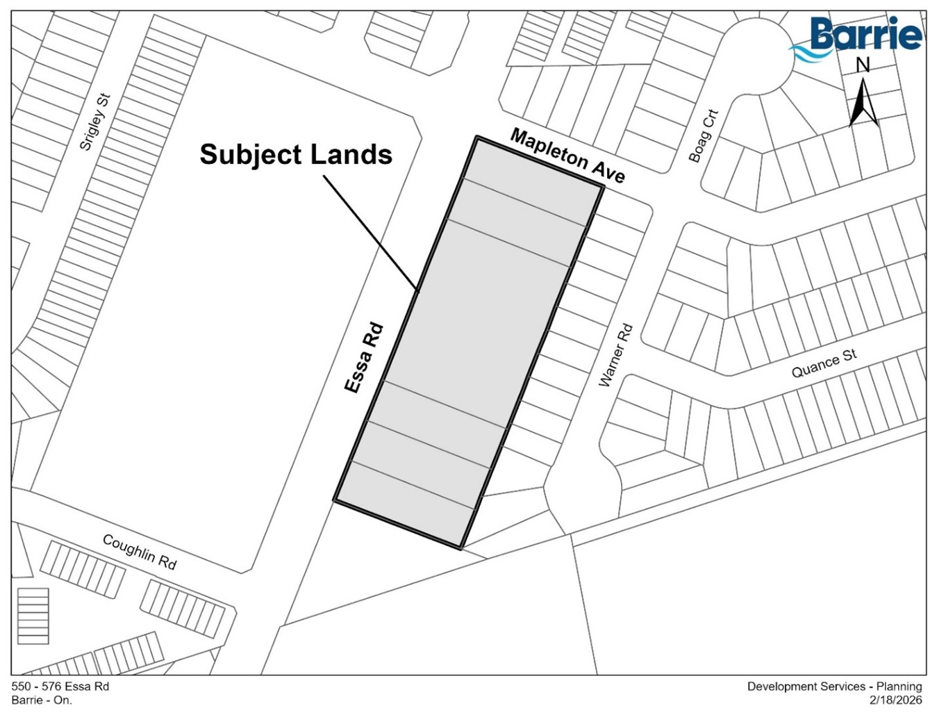
TAKE NOTICE that the Affordability Committee of the Council of the Corporation of the City of Barrie will hold a public meeting on Wednesday, June 03, 2026 at 6:00 p.m. to review application submitted by MHBC Planning Limited on behalf of Saverino Developments Inc., for an Official Plan Amendment and Amendment to the Zoning By-law to permit a high-density residential development on lands described as Lots 7, 8, 13, 14 & 15 on Plan 1101 (Innisfil); AND Lots 9 to 12 on Plan 1101 (Innisfil) being Parts 1 to 6 on Plan 51R-43523; S/T & T/W Easements as in SC1439752 & SC1439753; All in the City of Barrie, and known municipally as 550, 552, 558, 570, 574 & 576 Essa Road.
This public meeting will be held in a virtual forum with electronic participation and in person at City Hall. The meeting will be livestreamed on the City’s YouTube Channel http://youtube.com/citybarrie.
If you would like to participate virtually, you will need access to a computer with internet service or a telephone. If you wish to provide oral comments at the public meeting, please register in advance by emailing: cityclerks@barrie.ca or calling 705-739-4220 x5500 during regular office hours prior to June 3, 2026 by 12:00 p.m. Once you register, you will be provided information from the Legislative Services Branch on how to make your submission.
Any person may attend the meeting and make representation or present submission respecting this matter. If you wish to make a written submission concerning this matter, please email or mail written comments to cityclerks@barrie.ca or City Hall, 70 Collier Street, PO Box 400, Barrie, ON L4M 4T5 (attention: City Clerk). Written comments must be received by June 3, 2026 by 12:00 p.m.